
Survey & Mapping
"DroneAxis Maps the Land So You Can Master Your Next Move"."
End-to-End Drone Survey Solutions
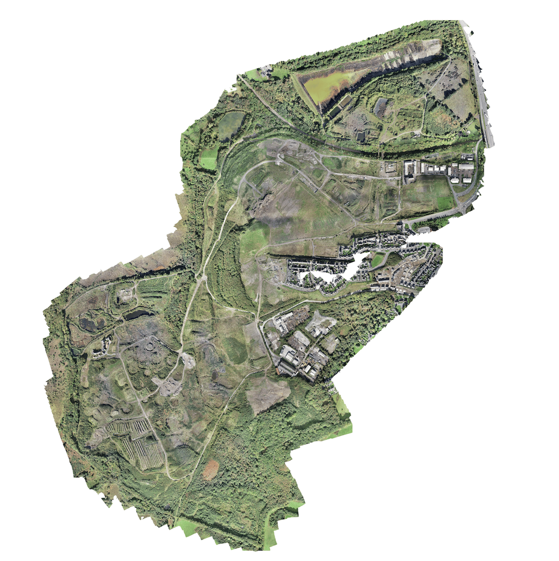
DroneAxis integrates drone mapping, DGPS, and total station surveying to collect accurate terrain data, achieving up to 3-centimeter precision, even in complex environments.
DroneAxis's drones operate on preset flight routes, capturing visuals from the same GPS coordinates during each deployment, which ensures reliable and repeatable survey results.
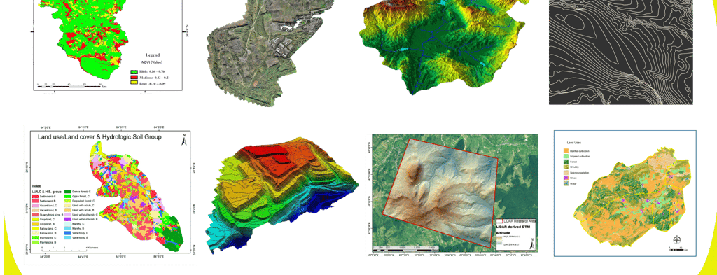
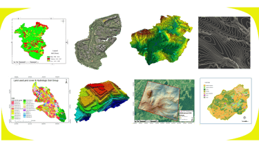
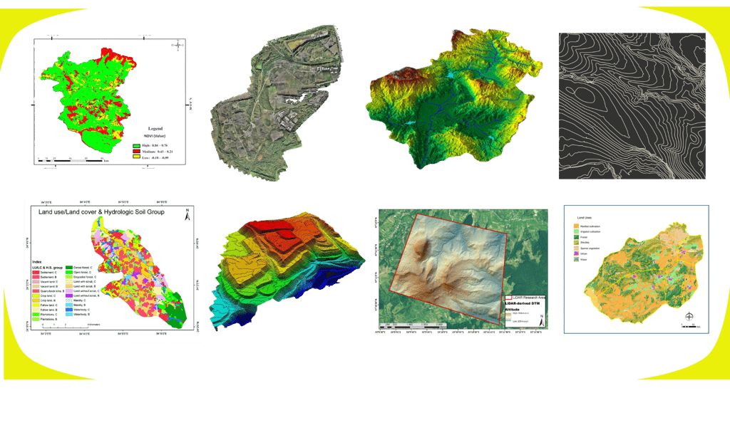
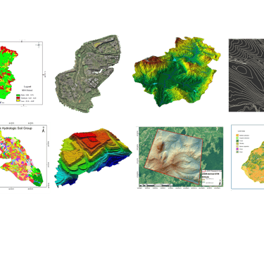
Deliverables
End-to-End Drone Survey Solutions
Write your text here...
DroneAxis integrates drone mapping, DGPS, and total station surveying to collect accurate terrain data, achieving up to 3-centimeter precision, even in complex environments.
DroneAxis's drones operate on preset flight routes, capturing visuals from the same GPS coordinates during each deployment, which ensures reliable and repeatable survey results.
Deliverables

Lets Connect !
Suman S
© 2025. All rights reserved.
DroneAxis is your one-stop solution for drone intelligence, construction monitoring, and business surveillance.”
suman@droneaxis.in
+91 9538507639
Founder & CEO
connect@droneaxis.in
💡Website designed & built by Suman S| Founder - DroneAxis

Registered Address -
Suman Ventures, DroneAxis.in, #M, 3rd Floor Sycon Workplace, MM Layout,
Kaval Bysandra, RT Nagar - 560032